


Σύμφωνα με τα προγνωστικά στοιχεία του Εθνικού Αστεροσκοπείου Αθηνών / meteo.gr, διαδοχικά κύματα κακοκαιρίας, κινούμενα από τα βορειοδυτικά προς τα ανατολικά, αναμένεται να επηρεάσουν τη χώρα έως τα μέσα της νέας εβδομάδας.
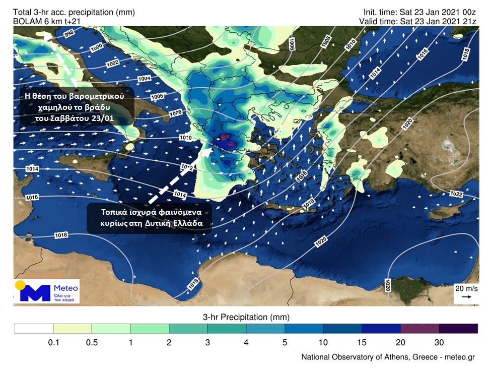
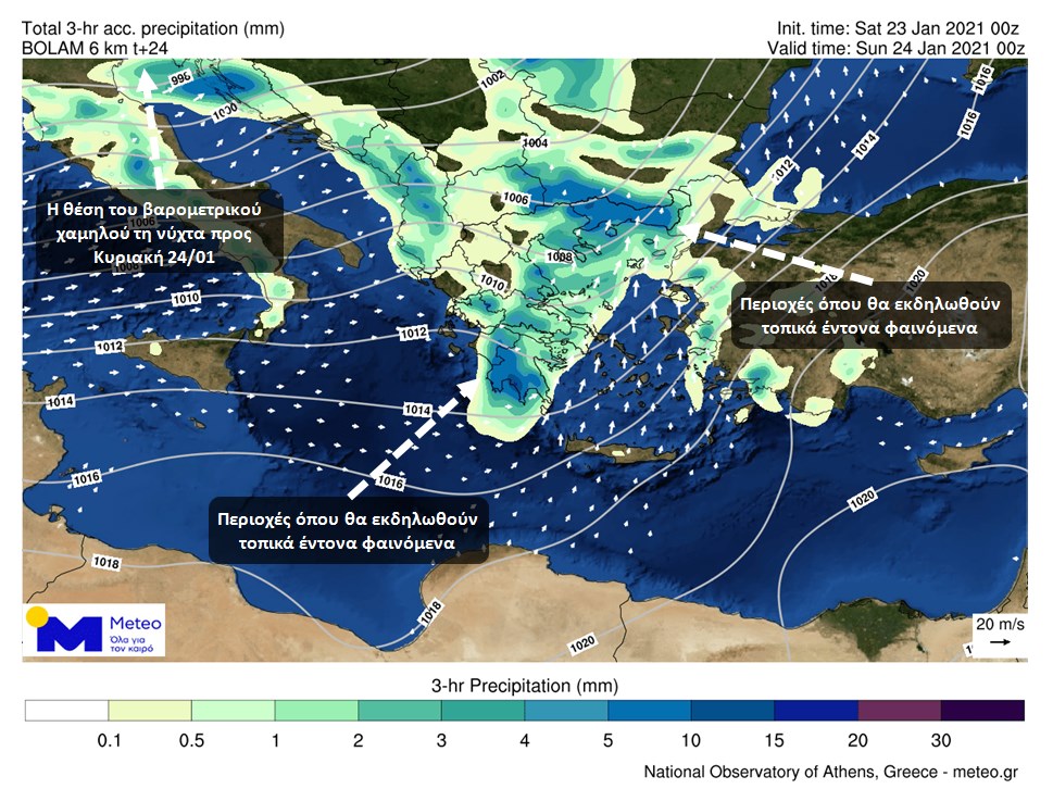
Το πρώτο κύμα κακοκαιρίας, θα επηρεάσει από τις μεσημεριανές ώρες του Σαββάτου τη Δυτική Ελλάδα με τοπικά ισχυρές βροχές και καταιγίδες και χιονοπτώσεις στα ορεινά. Τα έντονα φαινόμενα προοδευτικά θα επεκταθούν σχεδόν στο σύνολο της ηπειρωτικής χώρας και το βράδυ στο Κεντρικό και Βόρειο Αιγαίο. Τοπικά θυελλώδεις άνεμοι νοτίων διευθύνσεων θα επικρατήσουν στα πελάγη. Μέχρι το μεσημέρι της Κυριακής ο καιρός θα παρουσιάσει πρόσκαιρη βελτίωση σχεδόν σε όλη τη χώρα, με παράλληλη πρόσκαιρη εξασθένηση των ανέμων.
Στους προγνωστικούς χάρτες που ακολουθούν παρουσιάζονται η κατανομή των φαινομένων και οι άνεμοι που θα πνέουν, αργά το βράδυ του Σαββάτου και τις πρώτες μεταμεσονύκτιες ώρες προς Κυριακή.
Το δεύτερο κύμα κακοκαιρίας το οποίο θα έχει τα ίδια χαρακτηριστικά με το πρώτο, αναμένεται να επηρεάσει από τις απογευματινές ώρες της Κυριακής τη Δυτική Ελλάδα και βαθμιαία έως το πρωί της Δευτέρας σχεδόν το σύνολο της χώρας.
Το τρίτο κύμα κακοκαιρίας θα επηρεάσει τη χώρα το διήμερο Τρίτη -Τετάρτη, με τα έως τώρα στοιχεία να δείχνουν ότι θα συνοδευτεί από σημαντική πτώση της θερμοκρασίας και πιθανότατα χιονοπτώσεις ακόμα και σε περιοχές της Β. Ελλάδας με χαμηλό υψόμετρο.


