


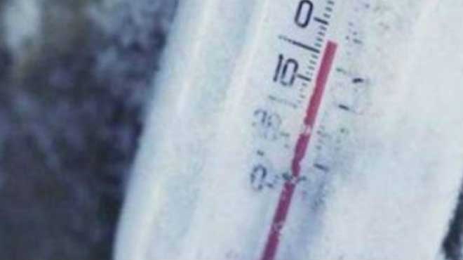
Από την ερχόμενη εβδομάδα έρχεται νέο κύμα ψύχους στη χώρα, μετά την πρόσκαιρη βελτίωση του καιρού το Σαββατοκύριακο.
Σύμφωνα με την πρόγνωση της ΕΜΥ, η ερχόμενη εβδομάδα θα είναι κρύα ενώ δεν θα λείψουν οι βροχές και τα χιόνια στα ορεινά.
Αντίστοιχα, όπως αναφέρει ο μετεωρολόγος Σάκης Αρναούτογλου σε ανάρτησή του στο Facebook «διαδοχικές κατεβασιές ψυχρών αερίων μαζών από τη βόρεια Ευρώπη αναμένεται να επηρεάζουν οριακά και κατά διαστήματα τα Βαλκάνια αλλά και τη χώρα μας. Πιο αξιόλογη και ισχυρότερη όμως δείχνει η ψυχρή αέρια μάζα που αναμένεται να κατέβει προς την περιοχή μας προς τα τέλη της επόμενης εβδομάδας 20-21 Ιανουαρίου!».
«Το κρύο θα είναι πιο τσουχτερό αλλά θα δούμε και αν θα δώσει χιονοπτώσεις και πόσο αξιόλογα θα είναι τα φαινόμενα», προσθέτει στην ανάρτησή του ο κ. Αρναούτογλου.
Από την πλευρά του ο μετεωρολόγος Κλέαρχος Μαρουσάκης, κάνει επίσης λόγο για ένα νέο κύμα ψύχους γραφοντας στο facebook ότι «οι τελευταίες ενδείξεις θέλουν ένα νέο ισχυρό κύμα ψύχους να μας απασχολεί τις τελευταίες ημέρες της άλλης εβδομάδας».
Στο βίντεο και προς το τέλος αυτού μπορούμε να δούμε το βαθύ μπλε χρώμα να κάνει και πάλι την εμφάνισή του προς τη χώρα μας, που σημαίνει ότι μια νέα ισχυρή ψυχρή εισβολή ενδέχεται να μας απασχολήσει. Μπορεί να μοιάζει μακρινή μια τέτοια εκτίμηση μιας και μεσολαβούν 6-7 ημέρες μέχρι τότε και πολλά μπορούν να αλλάξουν, μακάρι όμως αυτό το χρονικό διάστημα να είναι αρκετό ώστε ο καθένας μας να οργανωθεί προκειμένου σε περίπτωση που επαληθευτούν αυτά τα προγνωστικά σενάρια να μην μιλάμε για νεκρούς και καταστροφές αλλά για όμορφες εικόνες από χιονισμένα τοπία», αναφέρει ο κ. Μαρουσάκης.
Για την περίοδο μέχρι τη νέα κακοκαιρία ο κ. Μαρουσάκης σημειώνει: «ομαλό πεδίο βαρομετρικών πιέσεων αναμένεται να επικρατήσει τις επόμενες ημέρες γεγονός που θα μας οδηγήσει σε ήπιες καιρικά καταστάσεις. Δεν θα λείπει βέβαια το κρύο ιδιαίτερα τη νύχτα και νωρίς το πρωί με τον παγετό να μας συντροφεύει για τις επόμενες αρκετές ημέρες και είναι αυτό που θα πρέπει να προσέξουμε».
ΕΜΥ: O καιρός τις επόμενες ημέρες
Δευτέρα 17-01-2022
Στα δυτικά προβλέπονται νεφώσεις παροδικά αυξημένες με τοπικές βροχές. Στα ανατολικά θα υπάρχουν λίγες νεφώσεις οι οποίες βαθμιαία στο ανατολικό Αιγαίο, τις Κυκλάδες, την Κρήτη και τα Δωδεκάνησα θα αυξηθούν και από το μεσημέρι θα σημειωθούν τοπικές βροχές.
Η ορατότητα στα ηπειρωτικά τις πρωινές και βραδινές ώρες θα είναι τοπικά περιορισμένη και θα σχηματιστούν ομίχλες.
Οι άνεμοι θα πνέουν αρχικά από δυτικές διευθύνσεις 3 με 5 που βαθμιαία θα γίνουν δυτικοί βορειοδυτικοί 4 με 6 μποφόρ με τάση ενίσχυσης τη νύχτα.
Η θερμοκρασία θα σημειώσει άνοδο ως προς τις μέγιστες τιμές της και θα φθάσει στα βόρεια τους 09 με 12 βαθμούς, στα κεντρικά τους 11 με 13 βαθμούς και στα νότια τους 13 με 16 βαθμούς Κελσίου. Τις πρωινές ώρες στα κεντρικά και βόρεια ηπειρωτικά θα σημειωθεί παγετός.
Τρίτη 18-01-2022
Λίγες νεφώσεις κατά τόπους αυξημένες στα ανατολικά με τοπικές βροχές κυρίως στο ανατολικό Αιγαίο, την Κρήτη και τα Δωδεκάνησα και πρόσκαιρες ασθενείς χιονοπτώσεις στα ορεινά κυρίως της ανατολικής χώρας. Η ορατότητα στα ηπειρωτικά τις πρωινές ώρες θα είναι τοπικά περιορισμένη και θα σχηματιστούν ομίχλες.
Οι άνεμοι θα πνέουν βόρειοι βορειοδυτικοί στα δυτικά 4 με 6, στα ανατολικά 5 με 7, στο Αιγαίο τοπικά 8 και πιθανώς πρόσκαιρα το πρωί στο βορειοδυτικό Αιγαίο τοπικά 9 μποφόρ.
Η θερμοκρασία θα σημειώσει μικρή πτώση κυρίως στη βόρεια και ανατολική χώρα. Τις πρωινές και βραδινές ώρες στα βόρεια ηπειρωτικά θα σημειωθεί παγετός.
Τετάρτη 19-01-2022
Στη δυτική και βόρεια χώρα γενικά αίθριος καιρός με τοπικές νεφώσεις το βράδυ στα δυτικά. Στις υπόλοιπες περιοχές λίγες νεφώσεις κατά τόπους αυξημένες.
Οι άνεμοι θα πνέουν αρχικά βόρειοι 4 με 6 και στα νοτιοανατολικά 6 με 8 μποφόρ που βαθμιαία θα εξασθενήσουν και το βράδυ θα γίνουν δυτικοί νοτιοδυτικοί 3 με 4 και στα νοτιοανατολικά βορειοδυτικοί 4 με 6 μποφόρ.
Η θερμοκρασία θα σημειώσει νέα πτώση κυρίως στα ανατολικά. Τις πρωινές και βραδινές ώρες στα ηπειρωτικά κυρίως της κεντρικής και βόρειας χώρας θα σημειωθεί παγετός τοπικά ισχυρός στα βόρεια.
Πέμπτη 20-01-2022
Στα δυτικά, τα νότια, το ανατολικό Αιγαίο και τα Δωδεκάνησα νεφώσεις παροδικά αυξημένες με τοπικές βροχές, μεμονωμένες καταιγίδες και λίγα χιόνια στα δυτικά ορεινά. Στις υπόλοιπες περιοχές γενικά αίθριος με τοπικές νεφώσεις από το βράδυ. Η ορατότητα στα ηπειρωτικά τις πρωινές ώρες θα είναι τοπικά περιορισμένη.
Οι άνεμοι θα πνέουν δυτικοί νοτιοδυτικοί 4 με 5, βαθμιαία στα νότια και τα ανατολικά 5 με 6 και στο νότιο Αιγαίο τοπικά 7 μποφόρ.
Η θερμοκρασία θα σημειώσει άνοδο ως προς τις μέγιστες τιμές της. Τις πρωινές ώρες στα κεντρικά και βόρεια ηπειρωτικά θα σημειωθεί παγετός.
Παρασκευή 21-01-2022
Σε όλη τη χώρα προβλέπονται νεφώσεις παροδικά αυξημένες με τοπικές βροχές, σποραδικές καταιγίδες κυρίως στις θαλάσσιες και παραθαλάσσιες περιοχές και χιόνια στα ορεινά, βαθμιαία στα ημιορεινά της βόρειας χώρας και αργότερα στα ημιορεινά της κεντρικής χώρας.
Οι άνεμοι θα είναι αρχικά δυτικοί νοτιοδυτικοί 5 με 7 μποφόρ που βαθμιαία στα βόρεια θα γίνουν βόρειοι με την ίδια ένταση.
Η θερμοκρασία θα σημειώσει πτώση από τα βόρεια.
Πηγή: cnn.gr


